


Daintree dreaming…
Adventures with Grace
Source: About Grace
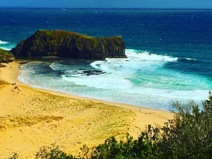
 The contrast between the ancient volcanic cliffy landscape with the pristine wild beaches makes Cape Schanck a dramatically beautiful place to visit at any time of the year. To avoid tollways, From…
Source: Adventure 1.5 hours from Melbourne to find Cape Schack and The Peninsula Hot Springs
With respect to Elders past and present we acknowledge that we walk on Boonwurrang Country 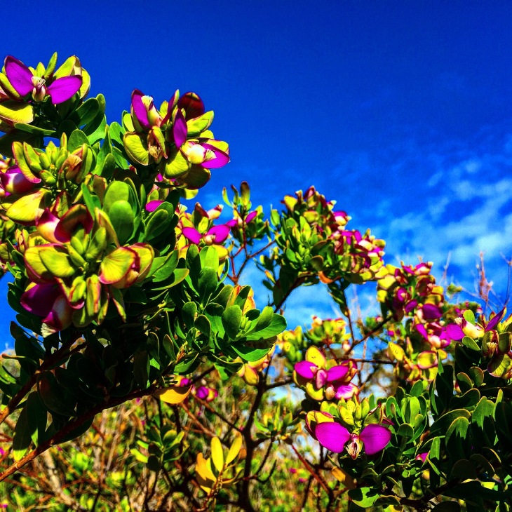
The contrast between the ancient volcanic cliffy landscape with the pristine wild beaches makes Cape Schanck a dramatically beautiful place to visit at any time of the year. Cape Schack is only a 1.5 hours drive from Melbourne. To avoid tollways, From Melbourne, take the Nepean Hwy, turn left at White St, right at Boundary Rd, Left at Springvale Rd, then right onto the Mornington Peninsular Fwy. When the Freeway ends go left at Boneo Rd, continue till you reach Cape Schanck Rd, turn right and continue to the car park. For a short but spectacular walk take the circuit from the car park kiosk that leads towards the cape. Enjoy inspiring views of Pulpit Rock and Devils Desk, and meander over the black rocky beach.
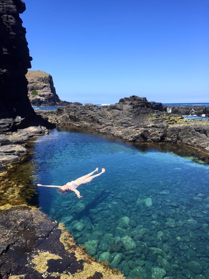
For a longer walk and some more of the best coastal scenery near Melbourne, go to the other end of the car park and follow the 2.6km Bushrangers Bay Track.


If you’re keen for a dip at Bushrangers Bay be cautious, the water is wild. You might get lucky if the tide is out and find the perfect rock pool to relax in. We’ve walked this track in all seasons and it always fills us with wonder.
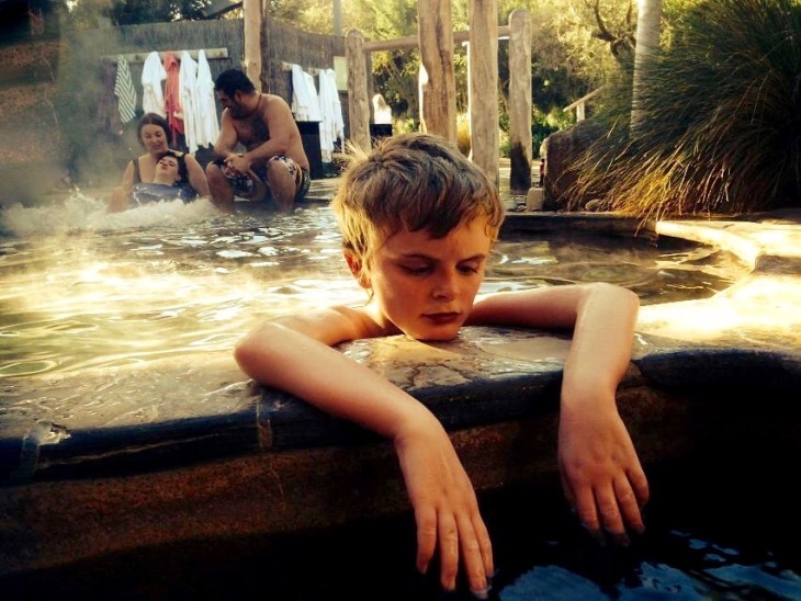
If you prefer to immerse yourself in warm water, after your hike head to Victoria’s only geothermal hot springs. We reckon this is the best way to soothe the muscles after a strenuous bush walk and warm the bones on a cold day. From Cape Schanck Rd, turn left back onto Boneo Rd, left onto Brown’s Rd and finally, left onto Springs Lane to find
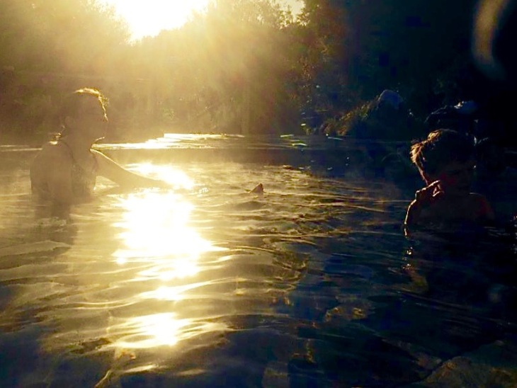
The Peninsula Springs is idyllic for singles, couples and families in rain or shine. After 10am, some spas are reserved for those over 16. You could spend a few hours or take a picnic and your favourite book and soak away the whole day. It’s a very popular destination for tourists and locals so make sure to book ahead.
For more adventures in The Peninsular National Park press here
With respect to Elders past and present, we acknowledge that we walk on Gadubanud Country.

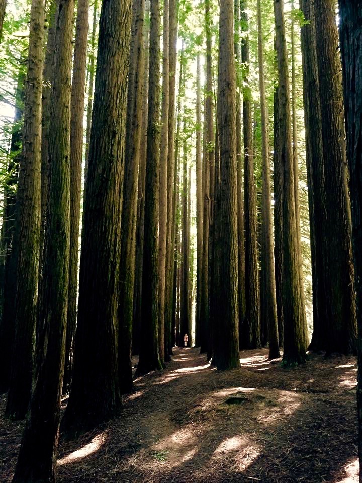
2.5 hours from Melbourne find Awesome forest, lakes fit for the Loch ness, towering redwoods, plus a sweet township that makes a coffee to rival the best of Lygon Street. This stretch of the Great Otway National park should not go missed. Pack a picnic and head out early on the Princess Hwy (M1) towards Geelong. Stay on the Princess Hwy then after Mount Moriac turn left onto Cape Otway Rd. Stop when you get to the town of Forrest. For a great Coffee go to the Forrest Brewing Company (they serve a pretty decent brekky too). After coffee/brekky, follows the signs to Lake Elizabeth
Lake Elizabeth is a great place to camp or visit for the day. It’s about a 1-1.5 hour walk around the lake and it’s worth it! it feels like a playground fit for prehistoric dinosaurs. To book a campsite or for more information on Lake Elizabeth press here
After your visit to Lake Liz head back to Forrest and take the Forrest-Apollo Bay rd. Drive for about 30 minutes then turn left at Beech-Forest-Mount Sabine Rd. When you hit the next fork stay left onto Seaview Ridge Rd. Along this track you will find the
Californian Redwoods
This is truly a picnic spot fit for little red riding hood.
Grab your blanket and your goodies lie down and enjoy the view.
")
")
")
 If time permits head back to Beech-Forest-Mount Sabine Rd and continue south to hit the Great Ocean Road.(it takes about 3.5 hours to get back to Melbourne this way). Enjoy the magnificent views as you wind along the road. Maybe even book ahead and find somewhere great to stay on this awesome Ocean Road. Or at least stop for a great dinner at the Wye River Hotel

For more adventures in the Otway National Park press here
With respect to Elders past and present we acknowledge that we walk on Boonwurrung Country
 I Hour Drive from Melbourne’s CBD Find the Dandenong Ranges. A great walk starts deep in the Ranges at Eagle Nest Picnic Ground.
National Rhododendron Gardens is also great place to take the kids for a picnic. Paved paths also make it a excellent place if you have a to pram to push around or require wheel chair access. Located near Mount Dandenong and just east of the Olinda township.
After your adventure in the gardens, head back into Olinda, (maybe grab a coffee or some Devonshire tea if that’s your thing) then keep going along the Mount Dandenong Tourist road to find
William Ricketts Sanctuary – Situated among the mountain ash, this is a place that is both beautiful and tranquil. In this natural setting, beautiful sculptures can be found half hidden among the ferns. William Ricketts’vision was one of a modern Australia that embraces Aboriginal spirituality and respects the natural world. A peaceful place for the whole family to meander.Find more adventures in The Dandenong Ranges here
To find one of our Free Grace Day retreats in the Dandenongs click here
To read an adventure story set in the Dandenong Ranges click here


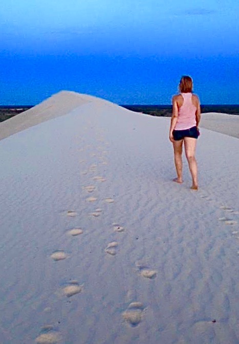
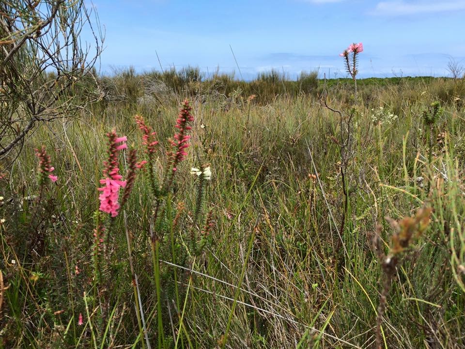
 Small coves with rocky headlands in our heart, our heads full of heathlands and wild flowers, we roll down white dunes to immerse in the waters of wide open beaches. Find Croajingolong National Par…
Source: Croajinolong National Park

Be directed towards awe inspiring locations in Victoria, Australia and beyond. With detailed directions, you can take yourself there, or contact us for guidance – For details on adventures click on this link – Grace Adventures
We acknowledge that we walk on Barrindji Country, and we offer our respect to Elders past and present of the Paakantji, Ngyiampaa and Mutthi Mutthi people.
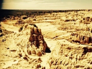
World Heritage Mungo National Park, home of the Mungo Lady and Mungo Man, a place rich in Aboriginal history. For current information on conditions at Mungo National Park press here


pace slow we quicken
a cold heart crossing
the sun dust indented
it scares us to be so
far into the heath
we choose a branch
and wander
and wonder
through the grass
some old curse
shedding
By Rebecca Sullivan

With respect to Elders past and present, we acknowledge that we walk on Bidawal and Nindi-Ngudjam Ngarigu Monero Country
Small coves with rocky headlands in our heart, our heads full of heathlands and wild flowers, we roll down white dunes to immerse in the waters of wide open beaches.Find Croajingolong National Park 450km east of Melbourne or 500km south of Sydney. Located in the far east corner of Victoria, the Park’s name is derived from the Australian Aboriginal Krauatungalan words gulling, meaning “belonging to” and Kraua, meaning “east”. The coastal park is met by the Tasman Sea of the Pacific Ocean. The scenery is spectacular and varied.
See links below for details on great adventures, camping, bush walks, and more at Croajinalong
For Shipwreck Creek to Seal Creek Hike Press Here
For More On Shipwreck Creek Camping Ground Press Here
")


